

BY HANNES THUM
In the late 1800s, the United States Geological Survey (USGS) wanted to find a way to measure the streamflow of the creeks and rivers in the West. The West was rapidly being explored in this era and the federal government was trying to quantify, or put numbers to, exactly what we had within our region as far as resources that could be used.
Water, of course, was one of those resources—water for agriculture, water for sustaining new towns and cities, and water for power.
John Wesley Powell (of Grand Canyon fame) was head of the USGS at the time and he knew well one fundamental fact about this region: water leads to life, aridity leads to less life, and the West is a pretty dry place overall. Thus, one of the USGS’s main missions (that continues today) would become measuring what water was where.
The USGS continues to maintain thousands of so-called “gauging stations” along western waterways that measure the discharge of streams and rivers. The data from many of these sites is beamed via radio signal to USGS servers (sometimes as often as every 15 minutes), and anybody with an Internet connection can access the data and see exactly how high or low a river is flowing on a given day.
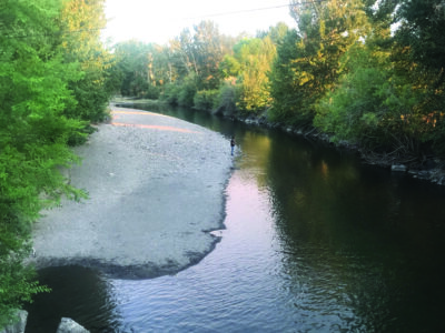
One of these gauging stations is installed right here in Hailey, underneath the Croy Creek Road bridge. And, as I write this, the measured discharge of the Big Wood River at that site is less than half of the average annual flow for this time of year.
This is, of course, concerning for all sorts of folks: the annual users of this water who have come to rely on a certain amount of water; firefighters who see the exceptionally low flows in the river as one sign amongst many that our region is abnormally dry this year; and, those of us who simply find ourselves worried to see our riparian ecosystems denied some of the moisture that they need to go about their annual life cycles.
The water in a river reflects the water in the watershed, and the water in the watershed is a reflection of the weather in the watershed. And, despite all of the ways we try to change Earth’s systems to suit us, there isn’t a whole lot we can do to change the weather in a place. The low water in the Big Wood system reflects a low snow year and, simply put: that’s what we have to work with this year.
There are two main things that we can do with the river as it is. Firstly, we can hope for the best for those impacted by the year’s low runoff and be understanding when decisions need to be made (as they have been and will continue to be) about how to allocate the water we have. And, secondly, we can see the shape of the river and the way it sits in its banks today and take note —there is much to be seen and learned from seeing it like this.