BY HANNES THUM
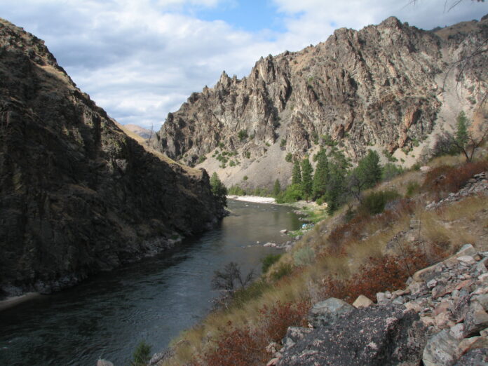
The Middle Fork of the Salmon River begins at the confluence of Marsh Creek and Bear Valley Creek, north of Stanley and a little ways off of Highway 21. At that place, where two quite different creeks come together (Marsh is steep and splashy and cold; Bear Valley is meandering and warmed by some hot springs and its slow path through the big meadows above), the waters merge and turn around themselves into an impressively deep pool called, appropriately, “Big Hole.”
From Big Hole, the Middle Fork plunges down through a narrow, twisting canyon. This section is occasionally boated by various humans on various crafts and one of the more notable aspects here is how condensed and tight the river is all the way down until Dagger Falls, a quite large rapid not often traveled by boat.
Dagger Falls, besides being a place with a road-access campground and a cool viewing platform for watching up-migrating salmon climb the falls, marks another “beginning” of the Middle Fork in the sense that just around the corner is the staging area and boat ramp from which 99 percent of Middle Fork river trips start their journey—a place called Boundary Creek.
From there, it’s almost 100 miles of stunningly beautiful water and canyon and wildlife and Ponderosa pine and fish and pools and rapids (and poison ivy and rattlesnakes) to where the Middle Fork of the Salmon River ends at its own confluence with The Main Salmon River Itself. Water from that point is on its way to the Pacific Ocean.
The Middle Fork is a pretty special and important place to a lot of people, and to a lot of non-people. It flows through the heart of a highly intact (for this day and age) and unadulterated ecosystem. Despite the fact that Skittle-colored boats dot its course every day of summer and that something like ten thousand people will go down through the canyon every year and that there are various airstrips and cabins and lodges along its banks, this is a place that is easy to recognize as a powerfully healthy piece of nature.
There’s an odd thing going on this year, though; namely, the water is low. Very low.
River levels are impacted by snowpack and snowpack is impacted by snowfall. And if less snow ends up on the ground in the winter, we see the results in the summer. This year, the river levels on the Middle Fork in June will approach the low levels usually not seen until August.
It’s hard to draw a straight line between global human impacts and watershed-level impacts. And one low year by itself does not make a trend. But, it will be important for us, as stewards of this landscape and of the waters in our region, to keep a close eye on how places like the Middle Fork are doing. Ecosystems like this are both resilient and vulnerable—and water is the lifeblood of the canyon. What happens if the water changes?


